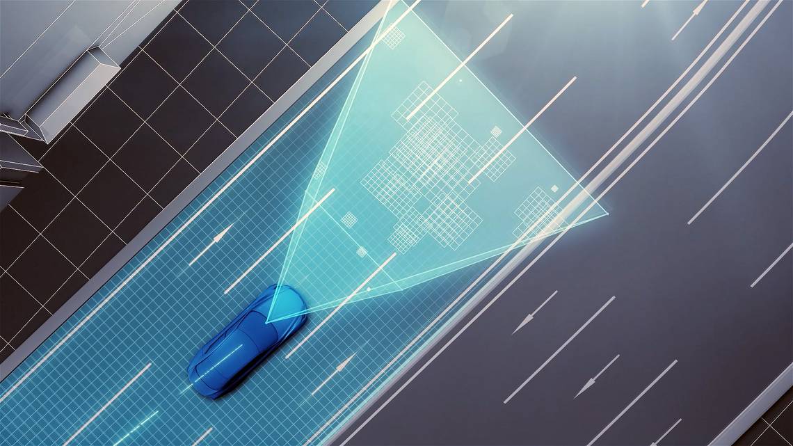
We hear a lot of hype about autonomous cars, but it isn’t often that we hear about what goes on behind the scenes. I’m specifically talking about how these self-driving->ke5282 cars happen to know where they are going, the local traffic laws, road signs, and dividing lines. Your common GPS unit can show you a reasonably accurate map of the road, but very few can break it down into an accurate display of lanes, and none – that I’m aware of – display actual traffic signs. Up until this point, map data for autonomous vehicles is provided by other vehicles that are equipped with laser scanners. Data collected eventually has information like dividing lines and road signs manually inserted. This method is effective, but is expensive, subjected to errors, and isn’t updated frequently. Toyota->ke88 is about the change the game, however, with a new system that will offer higher precision and won’t require as much manual editing.
Toyota’s new system will work somewhat like the current system used in Google’s self-driving cars. Cameras are attached to regular production vehicles, record the road, road signs, and various aspects of each road. In combination with GPS information, this information is uploaded to a special data center that automatically compiles all of the information in usable, high-precision map data. Toyota has noted that there is a higher potential for error with camera-based systems in comparison to current technology, but has stated that the margin of error can be dramatically reduced by combining data from multiple vehicles.
This technology is set to debut at the Consumer Electronics Show->ke3008 in Las Vegas between January 6th and January 9th, 2016. Toyota’->ke88s vision is that this technology->ke1701 will be a primary element that will make it possible to have self-driving vehicles by the end of the decade. At the start of things, this technology will be used primarily to map highway roads, but it will eventually evolve to map out ordinary roads as well. In a perfect world, Toyota hopes to collaborate with other map makers and encourage the widespread use of the technology.
Continue reading for the full story.
Why it matters

I’m sure we all remember the problems that came about by early GPS technology. There was nothing worse than relying on a system that was inaccurate and often led you to drive in circles. Even worse, sometimes it would take you into parking lots it mistook as a road, and lets not even touch on the concept of road closures due to construction. That kind of thing is why this technology is so important when it comes to reliable self-driving cars. Self-driving cars will ultimately prove to be much safer, but we’re approaching the technology at a slug’s crawl for a reason – if the technology isn’t flawless, it will do more harm than good.
For autonomous cars to be safe and useable by the masses, the technology must be perfected, and the data they rely on has to be accurate. This technology is a step in that direction. Considering the camera based systems will be installed on production vehicles, I wouldn’t doubt it if eventually every car comes equipped with the camera technology and connectivity to the cloud. As the masses go about their everyday business, new data will be uploaded – ultimately allowing on-the-go updates to self-driving cars in regards to road conditions, changes on the roadway and the like. I see it turning into a system where every car on the road is constantly uplink to a massive server that takes and supplies new information. There will always be those that question motives, and if this technology does evolve into that, it will surely raise the issue of privacy and tracking. We’ll leave that for a future debate, though.